
Walk a Peoria Street by Record
Start the Peoria street directory with one exact address. The county map can locate its parcel and nearby shapes. The assessor then supplies the APN, tax owner, situs address, mailing destination, legal description, and sale leads. APN means assessor parcel number. It is the key that helps match the same land across the map, tax account, plat, permit, and deed records. Ownership is public evidence. Occupancy is a separate question.
A whole-street search grows outward from that confirmed parcel. Adjacent polygons expose the rest of the block, while a line, rectangle, circle, or polygon can collect a wider group. Check the city-limit and county layers before moving to the record offices. Most Peoria parcels use Maricopa County systems. A small northern municipal strip requires Yavapai County records once GIS confirms the county.
- Standardize the address and open it in Parcel Viewer.
- Capture the APN, legal description, situs address, and current tax owner.
- Select nearby parcels or draw the exact street segment needed.
- Follow each owner into the Recorder’s deed index and verify the same legal description.
- Use lawful voter-file access and historic householder directories only for the periods and people they actually cover.
Note: A tax owner, voter, or permit applicant represents one role, not a complete household living there.
Map Peoria Streets in Parcel Viewer
The Maricopa County Parcel Viewer has three useful modes: Using the Mouse, What I Know, and Buffering Something. Address autocomplete accepts a number, direction, name, type, and optional ZIP. An intersection needs its street types and an ampersand or “AND.” Suggestions are limited, so incomplete street text may need refinement before the correct Peoria result appears.
After an address resolves, click the parcel and open Property Information. For the block, make Parcels selectable and click adjacent polygons, or draw a line, extent, circle, or polygon. Results can be created, added to, or reduced. A buffer can collect parcels entirely within a chosen distance or those touching it. Exports include CSV and GeoJSON, with a 1,000-feature result cap. Those tools make the viewer a street-directory workbench rather than a simple pin map.
Keep the selected feature type in view. A ZIP polygon, subdivision, or parcel layer can return a different kind of object even when the map looks similar. The Feature Information panel links a chosen parcel to Property Information, its sketch, imagery, street view, and Tax Summary. A subdivision result can open its recorded plat. Export only the fields needed for lawful research, and recheck each owner link against the current parcel detail before treating the table as a street record.
Search Peoria Street Owners
The Maricopa County Assessor search accepts an APN, street address, owner name, or subdivision. Owner-name help uses Last First without a comma. A parcel card commonly returns situs and mailing addresses, owner, legal description, tax area, land use, value history, lot and building facts, sales, and map or tax-summary links.
| Assessor field | Type | Street-directory use |
|---|---|---|
| Parcel Number | Text | Book-map-parcel key, accepted with or without dashes in the map |
| Street Address | Autocomplete | Number, direction, name, type, optional ZIP |
| Owner Name | Text | Last First format without a comma |
| Subdivision | Text | Name or MCR plat number |
The following screenshot is from the official Maricopa County Assessor.

Use the result to identify the parcel and tax owner, then test occupancy through other dated sources instead of treating the tax card as a resident list.
Decode Peoria Street Record Terms
Four address terms prevent most street-directory errors. They can disagree without any agency making a mistake. A Peoria postal label routes mail. The incorporated boundary determines city jurisdiction. The parcel county selects the assessor and recorder. The deed’s legal description identifies the land even if street numbering or a preferred city name changes.
- Parcel
- A mapped land unit identified by an APN.
- Situs address
- The physical tax location of the parcel.
- Mailing address
- The destination for owner tax correspondence, which may be elsewhere.
- Plat
- A recorded map of lots, blocks, streets, and easements.
- Criss-cross directory
- A historic address or telephone index that points back to a listed name.
Peoria’s Phoenix-grid avenues, directional prefixes, northern curved streets, annexations, and ZIP mismatches make these distinctions practical. No verified source supports a single citywide renumbering date, so use plats, centerlines, hundred-block data, legal descriptions, and neighboring parcels to bridge an uncertain address.
Compare Peoria Street Directory Sources
Each Peoria street record covers a different slice of the address. The parcel map supplies geometry and links. The assessor describes the current tax account. The Recorder ties named parties to instruments. The Treasurer shows tax billing and payment context. Accela dates building work. Voter files and historic householders can name some people at an address, but their eligibility, protection, edition, and participation limits remain part of the result.
| Record Set | Keeper | What It Shows | Access |
|---|---|---|---|
| Parcel and tax card | Maricopa Assessor | Owner, situs, mailing, APN, legal description, building and sales | Free portal and counter |
| Parcel GIS | County Assessor and Peoria GIS | Boundaries, adjacent parcels, ZIP, subdivision, city limit | Free viewer and export |
| Deeds, plats, and liens | Maricopa Recorder | Parties, dates, legal identity, instrument image | Free index; copies by request |
| Voter data | County Recorder | Registered voters at supplied addresses | Lawful written request; protected voters omitted |
| Building permits | Peoria Development Services | Project actors, work description, dates, status | Accela and city request |
| Householders directories | State Research Library | Listed occupants by address in an edition year | Digitized collection and reading room |
The durable chain is address to APN, APN to legal description, legal description to recorded instrument, and dated sources to a possible occupant. This is why the street directory should never be reduced to a copied list of owner names.
Note: Preserve the APN and exact legal description when two nearby Peoria parcels share similar street text.
Build Peoria Street Deed Chains
The Recorder’s name index reports coverage back to Maricopa County’s organization in 1871 and more than 52 million searchable documents. A street address is not the reliable search key for every older instrument. Begin with the current tax owner, find that owner’s acquisition deed as grantee, record the grantor, recording number, date, document type, and legal description, then search the grantor as an earlier grantee. Repeat only when the land description still matches.
A grantor gives or transfers an interest. A grantee receives it. A deed of trust can represent financing rather than a sale, a quitclaim need not be a market purchase, and a parcel split can change the land being conveyed. Trust and company names require their own searches. The assessor sales table is a lead, not a substitute for the recorded instrument.
If a name search appears to stop, try surname variants, the trust or LLC name, a narrower date span, and a different document code. The reported 1871 corpus makes spelling, indexing, and legal-description issues more plausible than a general online cutoff. Recorder staff and the underlying books remain the fallback when an image or index link fails. Review the official recording and copy fee schedule before ordering.
The parcel billing companion is visible through the Maricopa County Treasurer parcel search.
The Treasurer can confirm tax and payment context for a parcel, while the Assessor and Recorder remain the control sources for parcel identity and recorded ownership instruments.
Bridge Peoria Streets With Plats
A plat is often more durable than a house number. Parcel Viewer links subdivision results to recorded plat PDFs and allows searches by subdivision name or MCR number. Lot, block, and legal-description text can reconnect a street-directory entry with the correct parcel when OCR is poor, a mailing city differs, or development changed the surrounding roads. Cross streets and neighboring owners offer added controls.
Boundary layers matter most in north Peoria. ZIP, city, school, and county lines do not coincide, and annexation can change city services without changing the USPS preferred name. Old Town and 85345 fit early plats, the small Sanborn set, and mid-century directories. Central subdivisions fit assessor, plat, and later telephone evidence. Large 85383 communities usually require subdivision, APN, city-limit, and county overlays before a whole-street selection means anything.
When an old and new address cannot be reconciled, mark the link uncertain. A forced match creates a worse address record than an honest gap.
Date Peoria Street Changes
Peoria Accela can search building records by record number, project name, street-number range, directional prefix, street name and type, parcel number, and date range. The range controls are useful for one block. A permit result may identify an applicant, contractor, work description, project address, status, value, and milestone dates.
The official Peoria building-permit interface appears below.
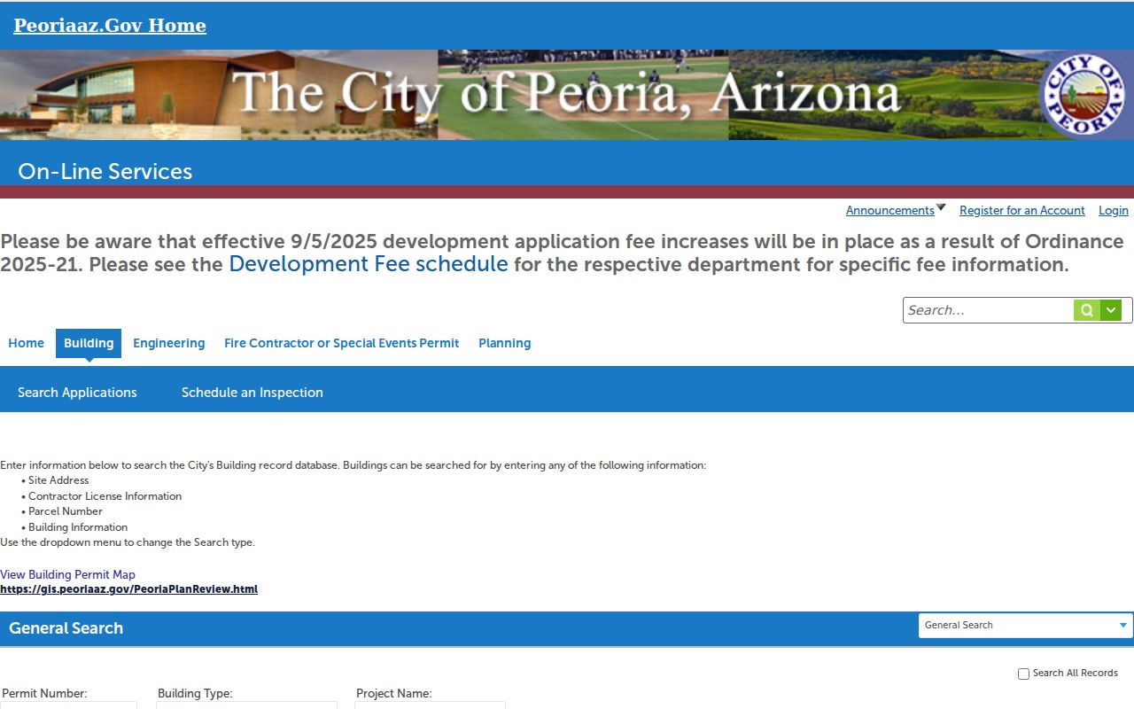
Permits date construction activity, not every move. Match the permit parcel to the assessor and use the named actor only in the role shown. No authoritative online start year was found for this Peoria database, so older or missing records call for a focused city request rather than an assumed cutoff.
| Accela control | Street search value |
|---|---|
| Street No. From/To | Defines an address range on a block |
| Direction, Name, Type | Separates structured street components |
| Parcel Number | Links the city project to the county APN |
| Start and End Date | Narrows issue or application periods |
Read Historic Peoria Street Directories
The 1949-50 Salisbury directory includes a numerical “Directory of Householders, Occupants of Office Buildings.” It orders addresses along each street and can include intersecting streets, occupants, and tenure indicators. The 1954 Official Glendale-Peoria Directory adds an explicitly Peoria-titled checkpoint. Mullin-Kille editions from 1957, 1959, and 1961 and the 1962 Cole criss-cross source carry the trail into a later era.
Historic entries can show a personal name, spouse, shortened occupation or employer, and residence. OCR often misreads columns and abbreviations, so inspect the page image and key. Pair a directory year with the public 1950 census, deeds, and tax evidence. A listed occupant may not own the parcel, while a deed owner may not appear at that address. That contrast is the main value of placing archival householders beside today’s assessor roll.
For collection history and reading methods, use the Peoria city directory collections without rebuilding the entire shelf in the street search.
Note: Telephone directories omit unlisted subscribers, and every printed edition describes only its own publication period.
Respect Peoria Street Directory Limits
No Peoria street directory creates a full present-day household list. Parcel data names tax owners, not all occupants. The voter file excludes nonvoters and protected registrants. Permits identify project actors. Historic books miss unlisted homes and years between editions. Private occupants, children, utility customers, delivery data, and Address Confidentiality Program participants stay outside this method. Driver records are restricted under the federal Driver’s Privacy Protection Act.
Commercial neighbor products can merge tax, marketing, and directory data, then confuse an old owner with a current resident. Use official sources to verify the category each name represents. Correct an error through the original custodian with the APN, instrument, case, or request identifier. Do not try to defeat a portal control or infer a protected address from nearby parcels.
Lawful use. Peoria address records support genealogy, property history, civic review, and personal safety. Arizona law does not excuse stalking, harassment, threats, or disclosure of protected addresses.