
Peoria ZIP Directory Coverage
A city-affiliated relocation resource identifies five codes in which most Peoria residents live. Older Superior Court assignment lists also associate two nonstandard codes with Peoria. That makes seven useful entries, but not seven equal residential zones. The postal directory must preserve that distinction.
| ZIP | Peoria area | Postal reference | Search note |
|---|---|---|---|
| 85345 | Old Town and south-central Peoria | Peoria delivery identity | Established neighborhoods and civic core |
| 85381 | Central Peoria and parts near Arrowhead | Peoria Post Office at 8380 W Emile Zola Ave | Use subdivisions to refine parcels |
| 85382 | North-central Peoria, P83, Westbrook and Ventana vicinity | Peoria delivery ZIP | Developed parcel and plat trail |
| 85383 | Vistancia, WestWing, Sonoran Mountain Ranch and Lake Pleasant approaches | Peoria delivery ZIP | Broad growth and desert area |
| 85373 | Northwest developed edge near Peoria | Sun City postal identity | Overlay the Peoria city limit |
| 85380 | Peoria-associated nonstandard code | Confirm current type with USPS | Do not assume a residential polygon |
| 85385 | Peoria-associated nonstandard code | Confirm current type with USPS | Do not assume a neighborhood |
Old Town, mature central subdivisions, and the northern master-planned communities leave very different record trails. A postal code is therefore a first cut. In broad 85383, a subdivision or parcel number is far more exact than the code alone. In 85345, old plats and regional directories can add historic context.
The 85382 entry covers north-central developed Peoria near Westbrook Village and Ventana Lakes, while 85381 reaches central sections and areas near Arrowhead. These descriptions are practical guides, not surveyed boundaries. For a lot near an edge, the parcel shape and city-limit overlay control the records decision. The code on an envelope only controls mail routing.
Verify a Peoria ZIP
Start with the mailing authority. The USPS address-to-ZIP lookup standardizes a current deliverable address. Enter the street number, street name, city, and state as requested. Directional prefixes matter in Peoria's Phoenix-area street grid. Curved roads in northern communities also make guesses based on avenue numbers unreliable.
The USPS result answers a mail-routing question, not a city-limit question. Keep the standardized form for later portal searches, especially when an assessor autocomplete rejects a loose spelling.
The USPS address-to-ZIP form is shown below as it appeared during research.
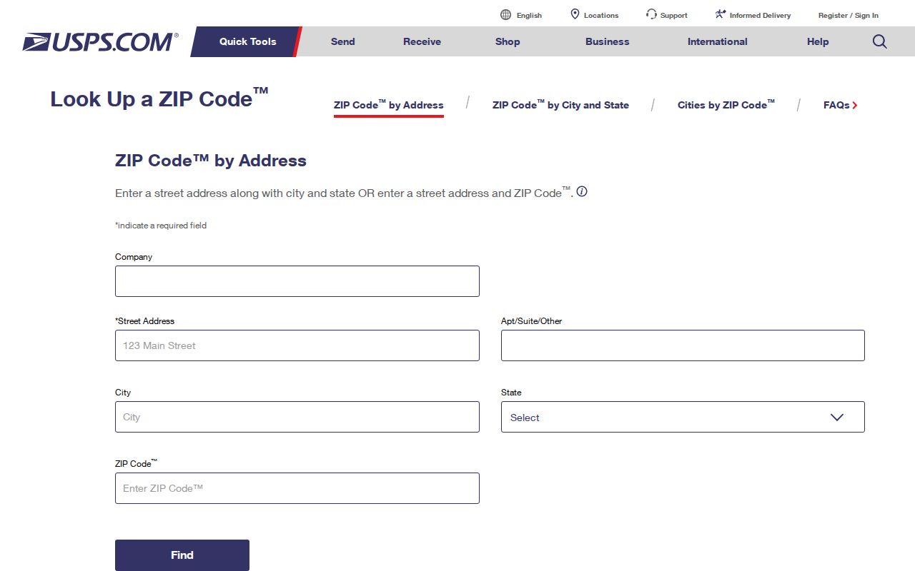
The form gives a sound postal starting point before Peoria GIS and county records settle the parcel's jurisdiction.
Note: USPS confirms delivery geography, while Peoria and county maps determine civic and records jurisdiction for public files.
Search Peoria Residents by ZIP
The Peoria ZIP search works best as a funnel. Maricopa County Parcel Viewer offers a true code-wide layer. The ordinary assessor address search, by contrast, uses the code only as part of a specific address. Arizona's voter self-lookup is for a person checking their own registration and is not an open ZIP-wide resident browser.
- Confirm the current code and standardized address through USPS.
- In Parcel Viewer, choose Search By, What I Know, Zip Codes, then Zip Code.
- Intersect the returned area with parcel features and display the Peoria city-limit layer.
- Open a parcel's Property Information link to check its situs address, owner, APN, and legal description.
- Once the area narrows to a road, use the Peoria street directory workflow for address-level research.
A situs address is the physical tax location. An APN is the assessor's parcel number. Neither field lists every occupant. They establish which land record is being examined and prevent a postal match from being mistaken for proof of residence.
Peoria ZIP Map Controls
The Parcel Viewer search help documents several ways to move from a Peoria postal zone to actual parcels. Its ZIP function returns an information layer. Mouse shapes and selection tools then identify parcels within the area, subject to the viewer's 1,000-feature result cap.
| Viewer control | Input or choice | Role in a ZIP search |
|---|---|---|
| Search mode | What I Know | Opens named criteria instead of map drawing |
| Layer | Zip Codes | Selects postal geography rather than parcels |
| Value | Five-digit code | Returns the matching ZIP feature |
| Parcel selection | Line, extent, circle, or polygon | Collects intersecting parcel features |
| Output | Attribute table, CSV, GeoJSON, or search URL | Supports careful review of a bounded result |
The official Parcel Viewer search help demonstrates those ZIP and spatial controls.
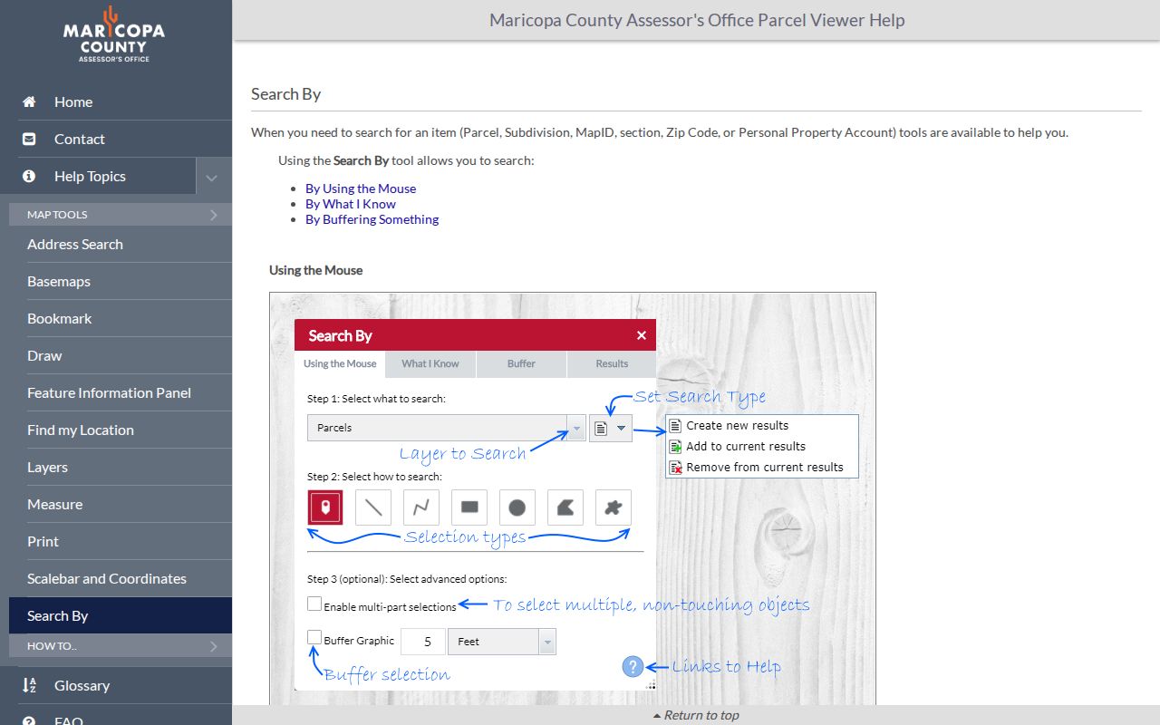
The important shift is from one large postal shape to selected parcel records. A code-wide map is not a ready-made residents list.
Parcel Viewer also accepts parcel owner, subdivision name or MCR, section-township-range, map ID, and personal-property criteria. Its address geocoder is separate. Accepted examples range from a simple number and street to a full directional address with ZIP. Suggestions are capped at ten, so adding the correct direction or street type can resolve an incomplete result.
Note: Select parcel features after loading the postal layer, since a ZIP polygon alone returns geography rather than resident records.
Peoria ZIP Records by Era
Postal geography also signals which evidence is likely to help. For 85345, Old Town plats, early Maricopa County deeds, a three-sheet 1927-31 Sanborn catalog record, and 1949-54 directories can support historical work. The Sanborn sheets describe the compact historic town, not modern north Peoria.
In 85381 and 85382, subdivision names, MCR plat numbers, assessor construction data, and later telephone or directory evidence fit the developed parcel pattern. An MCR number identifies a recorded subdivision map. It can link a modern lot to the plat even when mail formatting has changed.
For 85383, begin with subdivision or APN. The ZIP spans master-planned communities, growth areas, low-density land, and Lake Pleasant approaches. A code-only result can sweep in many unrelated places. Peoria's large physical footprint, documented in Census QuickFacts, makes that caution central to a useful postal directory.
Peoria ZIP Meets Sun City
The 85373 edge is Peoria's clearest postal-geography lesson. Mail may say Sun City even where the parcel touches or falls within Peoria municipal geography. The preferred postal name alone cannot settle city services, council jurisdiction, or the correct local records path.
Open the city-limit and parcel layers together. Then check the parcel county. Most Peoria residents and the historic townsite lie in Maricopa County, but the municipal extent reaches north into a thin part of Yavapai County. A parcel there belongs with Yavapai's assessor and recorder even if the broad place name says Peoria.
Boundary check. A Peoria postal label, city boundary, school district, and county line can describe four different areas.
Peoria's Nonstandard ZIP Entries
Codes 85380 and 85385 appear as Peoria-associated entries in older official court lists, yet the reviewed sources did not establish them as ordinary residential neighborhood polygons. Treat each as nonstandard or PO-box-related until USPS verifies the current delivery type. Do not map people to either code merely because a list pairs it with Peoria.
- ZIP
- A five-digit mail-routing code. It is not a municipal boundary.
- ZIP+4
- A finer delivery segment appended to the base code for a route, block, or recipient group.
- PO-box ZIP
- A code used for post-office-box delivery rather than assumed residential street coverage.
- Unique ZIP
- A code assigned to one high-volume recipient. The research found no basis to label Peoria's entries this way.
- Carrier route
- A USPS delivery path within a code, not a public roll of the people served.
No authoritative source reviewed for Peoria gave exact ZIP split years or station-by-station service boundaries. That gap is a reason to verify an address, not a license to infer a date or draw a new boundary.
Peoria Address Records Beyond ZIPs
When annexation, readdressing, or a city-created map matters, search the Peoria scanned-document portal. It supplies municipal records that can complement street centerlines, hundred-block data, recorded plats, and county parcel evidence. Large images may load slowly.
The Peoria scanned-document public-access screen below is a document channel, not a ZIP-wide people search.
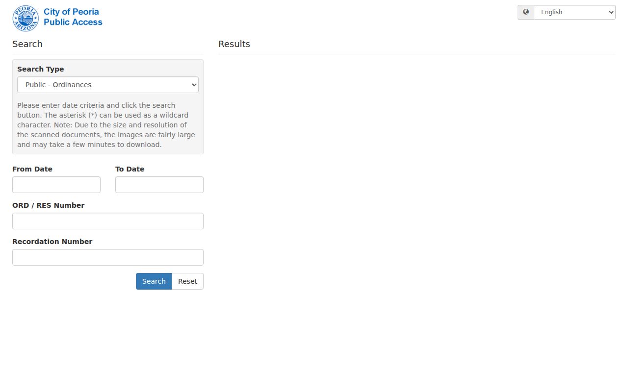
Use its city records to explain a boundary or address change, then return to the parcel's legal description for continuity. If no online item answers the question, the Peoria City Clerk accepts requests for non-police municipal records.
A sound continuity check captures today's USPS form, the current APN, the legal description, and the recorded plat. Then compare historic directory headings, hundred-block data, and annexation records. If an old number still cannot be reconciled, cross streets and neighboring owners can narrow the candidate, but the match should remain uncertain. Peoria research found no verified single citywide renumbering year.
Peoria ZIP and City Limits
A complete Peoria postal directory keeps delivery separate from government jurisdiction. Annexation can change city status and services without changing the USPS preferred city or code. County boundaries can also place a far-north parcel under another assessor, recorder, court clerk, and elections custodian.
For an uncertain address, keep a short evidence chain: standardized USPS address, APN, legal description, recorded plat, city-limit overlay, and county overlay. Historic work can add a directory heading and hundred-block data. Cross streets and neighboring owners may bridge an old number, but any unresolved match should remain labeled uncertain.
Note: A postal code narrows Peoria research, but parcel geometry and legal description identify the land that public records actually follow.